Sant Esteve d'En Bas (Olot)
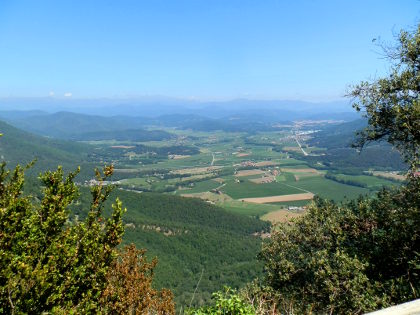 August is upon us and every car park on the Costa Brava is full, boats are moored in every cove and the whole place is buzzing in French, Dutch, German and English. So we headed out for a day to the Vall d'En Bas just south of Olot - a beautiful flat valley, verdent in the summer sunshine, beneath the hills and escarpments of the Garrotxa and Puigsacalm/Collsacabra. Starting out as mainly a visit, as we passed this way as we headed to Rupit, we found a walk up to the Emitage of Sant
 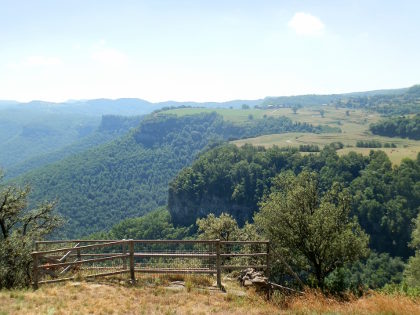 Miquel de Castello perched on a promontory high above the valley with great views along the valley to Olot and out to the Pyrenees.
The starting point was in the village of Sant Esteve d'En Bas a small village with some character and hidden streets of vaulted archways, but otherwise not particularly distinguished.
We park by the swimming pool, having discovered that the main road runs past the village quickly without obvious signs of parking by the church. We the head up the small hill to the older streets above the more modern parts of the village on the flatter plain below. The village looks out across the Bas Valley towards the escarpments on the other side of the valley, and on top of a small peak we can see the signs of a small chapel.
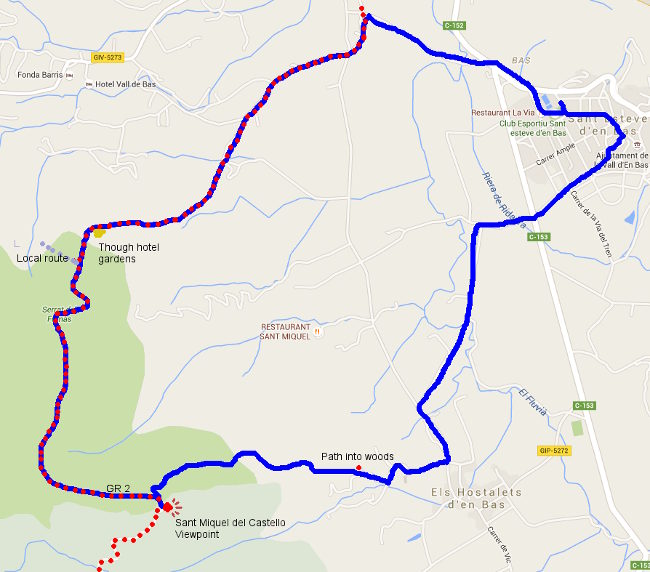
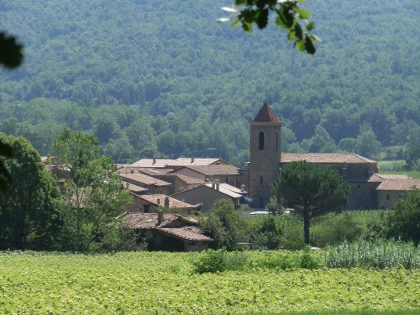 Taking a guess we leave the older streets and find a footpath marked by the scallop symbol for the local part of the route of Saint James (Sant Jaume), part of an old pilgrims route to Santiago de Compostella. This takes us into the flat of valley through the fields high with corn towards Hostalets.
Just before we get to Hostalets, we see the sign for the path to Sant Miquel. Guessing that this is the chapel above us we take the road up towards a few small farms. At the back of the last one we spot another sign which leads into a narrow track running around the back of the farmhouse climbing into the woods. Being August, the temperatures are still relatively high, so it's good to get into the moist shade of the woodland.
 The path climbs steadily - at parts steeply through stream beds, but the route is very clearly marked. It's a very steady 40-50 minute energy sapping climb through the woods leaving us sweating and breathing hard at times (do take water!). The trees around make it difficult to judge how far up we are, or how much further there is and the path zigs and zags as we climb.
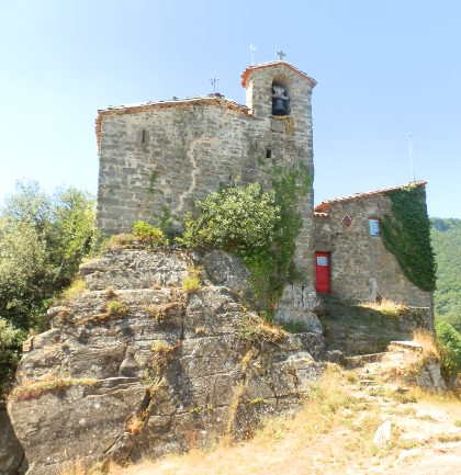
Eventually we hear voices above us and our steep path emerges at a flatter path at the top where a couple of families are heading down. The path passes through a cutting in the rocks before curling around to the promontery and the refuge of Sant Miquel del Castello. The refuge is run but GEiEG - Girona's long established excursion and sports club and in theory it should be possible to stay a night in the refuge, but it was shut when we were there, so probably requires prior arrangement to use it as a stay-point on a walk.
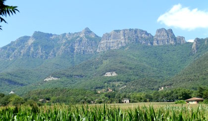 Sant Miquel is high above the valley floor with views almost all around. To the right we can look to the farms and meadows above the escarpments which almost Swiss-like with cows grazing, while to the left we can see the peaks of the Pyrenees devoid of snow now in summer, but presumably bright white in spring. Beneath us we have the valley floor a few hundred metres below us. The whole area is fenced off, but the drops are quite steep down.
After a little lunch and recovery, we return to the the path, following the route taken by the families down a steady downward path along the edge of the beech woods, leaves crunching underfoot. This is the GR2 - so another of the Grand Radonee major national footpaths and is marked by red-white flashes on the rocks and trees.
Downhill is easier than up, though there are a few steeper places. Midway along we pass through a sheep/goat field where the trees have been removed and the hillside opened to pasture - another Swiss-like feature. One of the amazing and enjoyable things with Catalonia is just how many different landscapes are in such a small area.
The path continues down and we pass other hikers coming up. As we get closer to the valley floor again, our path splits from the local path (to Joanetes) and we keep following the red-white flashes emerging, to our surprise, through the gardens of a hotel newly created from a restored masia farmhouse. We feel a little uncomfortable following our path (still the GR2) past their swimming pool with guest lounging at the side.
At the end of the hotel gardens, the route is a little unclear. I was going to head down the road, but instead we find the path a little over grown running along the side of the hill. Again for a national route the overgrown and unkept nature here is a little strange and we keep having to check we're on the right route. Eventually we emerge at the fields at the bottom and it's an easy stroll across the flat of the plain before turning back up to Sant Esteve.
Nearby: Olot - capital of Garrotxa - Palol de Revardit to La Mota - Sadernes and river pools of St Aniol d'Aguja - Rupit - Serinya and Illa del Fluvia - Els Set Gorgs (Campdevanol) - Banyoles lakeside walk

 Walks and other things