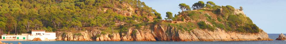
 Walks and other things
 One of the joys of the Costa Brava is the variety of landscapes and we like to visit places and walk (a lot), particularly into and around the Gavarres. Sometimes we travel around on bike. In the summer, we swim and canoe.
These then are write ups of walks, hikes and activities that we've done since November 2012, with photos straight from the original walk or activity.
We like to make circular walks and our walks range in length from about 4km (an hour) to around 16km (four hours) - but probably about 2 1/2 hours on average - though if you want to reduce the length, there are usually shortcuts.
To find walks by location, click on the map, which goes to a full sized map with links to individual walks and visits. To our surprise, we were listed in the Sunday Times' Essential Costa Brava (Feb 2017).
The most visited walks are:
- Calella de Palafrugell/Cap Roig to Castell - classic wild Costa Brava
- Far de Sant Sebastia (Llafranc) to Tamariu
- Platja d'Aro and S'Agaro
- Sa Tuna, Cap de Begur, Begur
- Eulogy to the Ruta del Tren Petit (Palafrugell, Palamos, Mont-ras and Vall-llobrega)
- Fornells and Aiguablava walk (GR92)
- Mont-ras to Calella de Palafrugell and Llafranc
- Platja de Castell and La Fosca
- St Antoni de Calonge, Torre Valentina to Platja d'Aro (almost)
- Escala, St Marti d'Empuries and beyond
- Bell-lloc and Castell de Vila-Roma (Palamos)
- Platja Sant Pol to Sant Feliu de Guixols
- Roses - Canyelles beaches to Cap Falconera
- Blanes, Lloret de Mar, Tossa de Mar by GR92
September on the Costa Brava
While July and August bring the summer season which is buzzing and lively, by the time September comes things are already settling back down to normal. This year the summer thunderstorms which mark the first transition came in August, but things continue to cool down during September, often bringing more rain later in the month.
For locals, the swimming and holiday season tend to run up to the Diada (11th September) which is the Catalan national day and signals the start of the school year. The first week of September is still OK for swimming in the sea, and this can stretch to the second week, but normally after Diada life is turning away from the beach and sea back towards walking and outdoor activities.
The second weekend is often taken as the close point for the season and the water park in Platja d'Aro and some of the more tourist-only places or facilities like canoe hire and campsites tend to close. The beaches retain their chiringuito beach bars, but even these are starting to close down and be removed by the end of September. Only the largest places like Lloret de Mar continue to have a tourist-y vibe, with beaches still full, if the sun is out, into the end of the month.
While the beaches are going quiet, there are still holidaymakers about - more normally older visitors unencumbered by school holidays and more for the restaurants and passeos by the beach.
The end of the month also typically brings rain and a freshness to the air after the dry and dusty days of the heat of summer. As a result locals emerge from their summers to head back to their normal work, and return to their active lives after the summer rest. Sports people appear on the beaches and jogging or cycling, preparing for the coming winter sports seasons. Inland restaurants fill with people walking and hiking and taking advantage of the cooler inland areas.
As a result the character changes back to what we would see as 'normal' after the high summer madness. We go back to walks and revisit old haunts that were too hot for walking in the summer. It feels like autumn is coming, but still with hot days, but also more rain.
August on the Costa Brava
It's out of sequence I know, but the peak high season weeks in August is all many visitors know about the Costa Brava when, in reality, it's quite different from the start of the year.
In discussing August, I really have to include the last two weeks of July. The actual holiday season is quite short. While locals might start swimming in June, the hottest weather tends to come at the end of July and the start of August, lasting up until the first summer storms and sea clouds.
This year has been extremely hot, reaching 40C in inland towns and into high mid-thirties (33-34C) on the coast. The water has also been exceptionally warm, getting up to 28C along a lot of the coast between L'Estartit and Blanes, albeit marginally cooler further north.
The temperature makes a big difference to the rhythm of the day. The temptation for holiday-makers is to head out to the beach and sunbathe all day, but local people often take a dip first thing in the morning, when the water is coolest and clearest, or into the evening after work, as the holidaymakers leave. Mid-day is for shade and cool if you can find it. Things happen late in summer for locals, even though holidaymakers arrive looking for dinner at 6pm.
It also means that inland towns get too hot for browsing or visiting. In Spring and Autumn they will have a lively bustle, but in mid-summer they can feel quiet and empty - at least until the night and the evening when they become active with food and festa majors.
Consequently, many August tourists will stick to the coast and coastal towns, creating a large tourist buzz (with a lot of French and Dutch visitors this year) that overwhelms the local rhythms, and obviously brings in a lot of business for every bar and restaurant working manically to make their sales.
The roads also fill up. Fridays and Sundays have traffic jams and tail-backs heading back to the AP7. Parking is crammed, and the roads become unpleasant to drive with rush-about visitors who drive too close and too fast (hey, you're on holiday, not on your commute to work).
Summer also brings lots of music festivals in addition to the festa majors up and down the coast - from Cap Roig to White Summer to Peralada to Port Ferrada. And at sea, all sorts of boat trips, canoe hire and water activity is available to get to somewhere cooler offshore. There's a lot going on if you want it.
In August our preference is to swim after work mostly - heading to the beach for 7pm, seeking out the cooler bays. In previous years, we've headed inland looking for river pools (Gorgs) to swim in, but that tends to be later in August when the hot days have broken. We do some 'tourist' stuff - a boat ride along the coast from Palamos this year - but mostly it's do less while the sun is burning. We also stop walking as it's too hot and uncomfortable. If you want to walk the GR92 do it outside peak summer.
This year the storms came just before the last week of the month, bringing relief from the heatwave and cooling the sea water to make it more pleasant for swimming and making the nights cooling for sleeping without air-conditioning. But the last week of August also feels like the season is coming to an end, and is already quieter than earlier in the month, the big French and European influx heading home.
For holiday visitors, August makes the Costa Brava feel like it is all about 'the resort' which is lively, fun and buzzing during the holiday season. Unfortunately, it always seems lock-in a view of the Costa Brava that is very summer-vacation orientated and misses out on the other things the Costa Brava has during the rest of the year.
January on the Costa Brava
The first thing to remember is that January starts late. Up until the 6th and the arrival of the Three Kings, which is when presents are traditionally delivered here, it's still Christmas. And the long Christmas period also encourages visitors out to the mountains for a little snow fun.
However, in general January is the quietest month around the coastal parts. The shorter days and post-Christmas abstinence mean even locals take a quiet month, and even for more locals-orientated restaurants it can be a time to take an annual break.
With people working, larger towns still have restaurants and bars that are open, but it's quiet and without the lights or pre-Christmas buzz of December.
Normally January would come with itchings to get to the snowy mountains, but this year is seeing drought in Spain and Catalonia with very little rain or snow. This is in contrast to northern Europe which has had its wettest winter for a while.
We travelling down to Blanes for a weekend walk early in the month. It was the scene of floods and a railway bridge washing away for years ago in Storm Gloria. Now everything is dry, and pining for rain. The town itself was surprisingly full with plenty of visitors out for paseo along the sea front, possibly up by train from Barcelona. A number of campsites were still open for motorhomes making winter tours. So while things are quiet they aren't completely closed.
For us, the shorter days mean less walking in the evenings. We have visited Calella de Palafrugell which still has a handful of places open even on January weekdays. Llafranc and Tamariu are more closed down, but pick up at weekends for lunches for hikers.
The beaches are generally empty, so we love to make the walk to the Gola de Ter at this time of year when the light is clear and the sand feels wild - better still after a storm when there's driftwood on the beach.
At home, fires and heating are on, though the days are rarely below 10-12C and at times have reached 20C - but unusually warm for this time of year. The Traumontana north wind does blow for a couple of days and can be biting in exposed places, but we know to walk in the leeside of Gavares if it does blow.
As the month ends, the days are getting longer with posters appearing for Carnaval that comes in February. A reminder that spring and Easter are on their way.
December on the Costa Brava
One of the common questions on travel forums about the Costa Brava is what is it like out of season? Over the next few months we'll try and give a flavour of what each month is like.
Unlike northern Europe, December in Catalonia is counted as autumn (Tardor). The month sees the build up to Christmas and lights and decorations appear in all the towns. Not least the Caga Tio - or poohing log - with its red hat that is a feature of Catalan Christmas. On Christmas day, young children are supposed to hit the log and it 'poohs' sweets from under its coat.
The weather in December does get cold in the evenings - and heating or a fire is needed - but day times tend to be more around 12-15C and with clear skies, December makes for good walking and exterior activities with lots of cyclists out of the roads as the month is often dry and mostly clear (this year we have a drought so it's been even drier).
As a result the buzz on the Costa Brava tends to move inland and into the working towns - Palamos, Palafrugell or Platja d'Aro, or fully inland to Girona and the hills, where people will be busy working. The days also take a more traditional Catalan rhythm with lunchtime meals in the masia farmhouses, and generally quiet during the evenings, though 'proper' restaurants still provide dinner services for those who book.
Those parts of the coast that rely on beach-side tourism tend to go quiet. Places like L'Estartit which are very focused on summer holidays feel shut up except for larger places that might open at the weekend for walkers or day trippers down from France, or up from Barcelona.
Near us, Tamariu and Llafranc feel empty during weekday evenings, with the only activities being workmen renovating, building or preparing for the next season. Neighbouring Calella de Palafrugell still has a knot of restaurants open by Port Bo during the day or in the evening. At weekends however, more places are open in general, catering for coastal walkers, the odd sunbather in sheltered places. It is not a time for swimming though, with few water based activities, though if the sea gets up you can find surfers at La Fosca, or the wind might bring Kite Surfers out in Palamos.
The main December life shifts to the towns, which remain vibrant, but with a much more local feel than summer. The people bustling around the streets looking for Christmas shopping will mostly be long-established residents. Sports are also common - football naturally, but locally they have basketball or handball, or tennis or padel.
December also brings lights and Christmas-focused activities like Pessebres Vives or living nativity scenes. School children will often be out selling raffle tickets for their sports club for the Christmas Quina or raffle, and tickets will be selling for 'El Gordo' or one of the other big Christmas lotteries that take place in December.
December is also a time for visiting friends and family, and the farmhouse restaurants out in the countryside always feel busy. Head towards Olot or Montseny or into the countryside for traditional Catalan food in old-style farmhouses with roaring fires - not too unlike the Cotswolds.
Christmas itself is different from a British style Christmas. The trimmings and meal expectations follow Catalan traditions like Canelloni, Galletes soup, fish and Escudella. Turkey does appear in the supermarkets, but often not until 2-3 days before the 25th. In Spain, January 6th, and the Three Kings is the day for presents, not the 25th, so the season stretches out beyond New Year.
New Year is also a different type of celebration, although it is changing to become a much bigger festival. The first years we lived here, we could walk into Palafrugell on New Year's Eve and absolutely nothing would be open, and the only people about might be someone walking a dog. The reason is that New Year is more of a family event until the 12 grapes eaten with the bells at mid-night.
After midnight people might go out clubbing or partying, then staying up until daybreak or a first (cold) swim of the year, but it's not an all-in hogmany. This year, Palafrugell was much more lively, with a gathering and DJ by the church. But even so, only one local bar was open and the site only really got busy 10 minutes before midnight just for the bells themselves. Palamos on the other hand often has fireworks and restaurants open for Cap d'Any meals. But it still lacks the mad fiesta feel of say London or Barcelona.
So December is a time to explore inland and for activities with other people. If you walk, cycle or horse-ride Costa Brava in December is an escape from the grey and damp, when the beaches are for walkers with dogs and woods and old farms are beckoning.
Finding the state of beaches - a useful link
It's summer and one of our common challenges is choosing which beach to go to for swimming (it's a hard life I know), particularly when there's a little bit of wind or the possibility of waves. Depending on the direction the beach is facing the sea can be like a millpond in one place and almost perfect for surfing some where around the coast. From where we are, just a little inland, it can be impossible to tell what the sea will be for swimming.
We have added webcams to give a little bit of a view, but I've just discovered that Gencat (the Generalitat or provincial government), keeps track of the state of the beaches and water - including whether stinging jellyfish have been seen.
https://interior.gencat.cat/ca/arees_dactuacio/proteccio_civil/estatplatges/
Our general practice is to start with beaches with shallower bays earlier in the season like La Fosca, then slowly move towards deeper water bays as the sea temperature increases since the water stays clearer and cooler.
And if you're new to the Costa Brava, it's worth pointing out that the town beaches, some of which can be a bit gritty and steeply shelving, often have neighbouring calas where the sand is finer, where there are more rocky areas for observing fish and that feel more like the classic holiday beaches.
Fornells and Aiguablava walk update
With the cooling of the weather we're back to walking old haunts and coastal paths. We decided to take one of the prettiest spots - the walk for Fornells and Aiguablava in Begur, which is one of the oldest walks on this site.
One of the issues with the walk has always been navigating around the back of the houses as you come up from Fornell's tiny, tiny beach, through what looks like someone's back garden, and with the sign posting often removed.
Well, it looks like over the summer that the path was updated with a new set of stairs climbing off the beach, so the problem with the private house has been removed. The top of the stairs gives a lovely view too back over the fishing houses of the hamlet.
Zina - An In Memoriam
Our very sad news is that Zina, our dog, passed away yesterday (14th Sept). Over the last few weeks she has been struggling with breathing and sickness which deteriorated very rapidly to the point that even the shortest walk along our street was too much for her. The vets diagnosed lung cancer and there was nothing anyone could do except to ease the pain.
Talk of dogs is normally very personal, and perhaps not so interesting if it's not your dog. But in Zina's case her life is intimately connected with this blog. Every walk we have described is also Zina's walk. If she had written it up I'm sure she would have described more of the smells and rustles and animals and cared a little less about the history or the view. But she came and explored, our constant companion as we discovered the details of the Costa Brava.
She joined us when we moved here as a young dog from the Rodamon Dog Shelter in Palafrugell - part of a promise to our children as we left Barcelona. And so she also accompanied them as they grew up through school and studies to the point of leaving home - always madly enthusiastic to see them when they came through the door.
So this blog is her blog too. She appears in the odd photo, and article, but we've tried to keep ourselves out of it a little so you wouldn't see her paw prints except in fleeting glimpses.
Unfortunately we didn't really see it coming. Her walks earlier in the summer were a little more hesistant, but we put that down to the heat. It wasn't until just 2-3 weeks ago that we realised how serious it had become. We had to rescue her by car from one of her favourite local walks because her breathing was failing and she could go no further.
Zina. Thank you. For all the happy memories from all the places that we've seen together.

Changing beaches in the summer
This year is proving very hot. As is our summer norm, it's too warm to do too much walking and inland has been hotter (up to 36C) than the coast (up to 32C), so we typically stay on the coast, working during the day, then going to the beach for a swim and cool off for the evening.
As with the air, the sea temperatures have also been warm. They are currently at 26-27C, about a couple of degrees warmer than other years. In shallower waters, warmer water encourages a harmless algae growth, so the water gets a green tinge with reduced water clarity.
For this reason, the beaches we use shifts as we go through the summer. The beaches best at the start of the summer are those that are a little shallower - so La Fosca or L'Estartit or parts of Platja de Castell.
As the summer comes on visitors arrive and parking gets harder, so our next criteria is ease of parking. This then takes us to Palamos, Platja d'Aro or Sant Pol for a quick park and swim.
As the temperatures rise, we start looking for deeper water as deep or open water tends to be cooler and clearer. We also like to start snorkelling a bit more, so the pebble beach at Tamariu (if we can find parking), or Pals beach by the rocks, where we can find good shoals of fish.
Now as temperatures are peaking, we'll head to cooler waters around Cape of Begur. Aigua Xelida for good swimming, that's off the beaten track with parking. We also went to Aiguablava, as the water is typically colder, but very late in the day (c20:00) as the beach is otherwise packed in summer.
Once the weather starts to turn, and the sea mists and storms come to cool everything off, we work back in reverse. We're not sunbathers, so we're happy just to have a quick dip. But our summer is the pick of the Costa Brava beaches as our after-work activity.
First swim of the season
June is upon us, and that means the start of swimming season. This year we've started a little later than usual because the first week of the month saw an inundation of unusually non-stinging jellyfish along the coast.
The jellyfish aren't the normal types we see in the water, but Aequorea forskalea or the 'many-ribbed jellyfish' which reports suggest are more normally found in deeper waters. The jellyfish were so harmless that children were scooping them out of the water onto the sand with their bare hands - not something to be advised for the stinging kind.
However, despite being harmless, their presence is still a bit off putting, so we delayed going swimming until this weekend with the air temperatures heading into the thirties (celcius).
We normally start with La Fosca area as the bay is shallower, and so the water gets warmer earlier in the season compared to some of the deeper bays. However, this year, our surprise was how much the sand had shifted over the winter. In previous years, the bay has a sandbank which allows for swimmers to stand even quite a way out from the shore. This year the sandbank has been levelled, so the water is deeper all the way out.
We also tried at Platja de Castell, and here too the sand has moved over the winter period. Our favourite spot at the far end is normally soft sand, but now entering the water requires stepping across rocks exposed on the seabed.
The changes are entirely natural. Coastal environments shift and change all the time. One of the delights is to walk on beaches at places like the Gola de Ter to see how the pattern of sea and sand shifts with the seasons. It's quite possible the sandbank will return, and the sand will return to Castell as the season progresses. The beauty of the sea is that it is always changing.
Girona Temps de Flors 2022
Temps de Flors in Girona is a major festival where buildings and gardens are opened and decorated with flowers in all sorts of artistic arrangements. We missed last year due to Covid, so we made a special effort to visit today, the opening day (it runs from the 7th to 15th May).
And we weren't the only ones with that idea, but that might also be because it's the first day. Girona felt full and lively with car parks full, and lots of international visitors. Bars and restaurants were heaving at lunch time, with queues in places.
One of the fabulous elements is the way seeing the flowers is mixed in with access to buildings, courtyards and gardens in the old city that are normally closed or shut off, and the change to catch glimpses of hidden old Girona.
We didn't attempt to see everything, but here are some photos of what we did see. Since the festival runs for a week, we might try again mid-week.


Ten years on...
It's ten years since we first started Costa Brava Living mostly to write up the walks, villages, beaches and highlights of this wonderful area.
In the beginning, everywhere was somewhere new and something to write up, whereas now we know our local area pretty well, and most of our favorite paths and routes have been written up. It's only travelling further afield, out to the Pyrenees or further reaches that we really find new as yet unwritten gems.
In ten years, we've noticed a lot more walking and walkers about, from casual family strollers to full on backpack and sticks hikers.
For visitors who only think of the Costa Brava as a summer destination, walking is a beautiful reason to visit at the shoulders of the season, like at Easter when the flowers are out and the temperatures are pleasant without being too hot, or into October or November when the air is clear, as an escape from the grey fog and cloud of more northern Europe.
Since we started, generally signposting has improved and paths along the coast have been upgraded. The maps have got a lot better - it's still a surprise that at the start there was a paucity of walking maps for places like La Selva. The tourist board here also recognises 'senderisme' or walking and hiking as major tourist attractions for the region.
And it's not just walking, cycling too has had a boost. Girona has always been a prime cycling centre for pro-riders, but cycling is much more mainstream with new paths and greenways, and plenty of opportunities to hire electric bikes if actual pedalling seems too much.
However, the best part is that the walks and routes remain largely unchanged - still as beautiful and out the way as ever. The winter storms wash away the paths or make repairs necessary, but the essential quality and character always remains. If we do see changes, we do add updates but by and large the walks remain the same.
We'll continue dipping in and out with articles but otherwise we'll just gentle pace ourselves with the odd bit of news now and then.
Opening of the new Palamos to Castell Cami de Ronda
The new Cami de Ronda that improves and updates the path from Palamos, around La Fosca to Platja de Castell opened today.
There are new raised wooden paths around the back of the Palamos Port that finally give Palamos a full coastal path connection, and routes to La Fosca and on to Castell have been updated. The path behind the port in particular is very welcome and the wooden walkways and bridge are excellent connections taking walkers away from the old road route (how they will hold up after a couple of winters will be interesting).
There has been some controversy locally, as the new paths have a lot more concrete and have removed some of the rustic feel of the old paths, particularly behind the picture postcard bay of S'Alguer which used to be more of a track, and now feels like walkway. Given the tendency for GR92 routes to age and weather, I think we'd be willing to see how it beds in.
We'll add some photos in the coming weeks. Meanwhile today was the first time for ages that the Costa Brava has felt busy. The easing of lockdowns for the Spanish has brought tons of people up from Barcelona, glad to get out of the city. Restrictions are still in place limiting numbers of people in restaurants, but it felt like the first day of holiday after a long period stuck in. We saw walkers and cyclists all over, taking advantage of the sunny weather and fresh air.
The lockdown was eased a couple of weeks ago, so we could finally leave Baix Emporda after 3 months confined to our locality. We have a report to write up from Vallfogona de Ripolles from a couple of weeks ago when we could finally get out to the mountains. France is still on lockdown which means many fewer foreign visitors. Let's hope the easing lasts...
Virtual Pop-up Artisan Market
Passing on a request from Anne-Marie Smith who runs an arts and craft business on the Costa Brava. Due to the shutdowns, many of the local artisan markets have stopped, which is making life difficult for crafters.
She has created a virtual market online on Facebook for the local community that other creators can join (and of course buyers can visit). The page is at:
https://www.facebook.com/ThePopUpArtisanMarket
I have no connection with Anne-Marie, but can appreciate the difficulties that COVID is wreaking on many small businesses here.
COVID state of play
Spain is seeing flashes of a second wave of COVID infections. In Catalonia outbreaks have hit more industrial areas around Barcelona, and out towards Leida and on to Aragon.
No second wave has hit the Costa Brava so far - so few new cases in this area - but several countries in Europe have put Spain on a quarantine list (eg UK, Belgium and Switzerland) and France is discouraging its citizens from crossing the border. However, the situation is very fluid. We're hoping schools and universities will be back open in a month's time, but who can be sure?
For visitors, the main effect of the lockdown is that access to smaller beaches is limited - they do reach capacity, particularly at weekends when it feels that half of Barcelona come up. Mid-week hasn't been so busy.
Most of the visitors seem to be Spanish or Catalan this year. There are a few cars from further afield, but nowhere near as many as usual. Hoewver, Friday night traffic up from Barcelona, or returning on Sundays is traffic-jam heavy.
Masks must be worn when out and about, but not at the beach, or in bars/restaurants or doing sporting type activities. Bars and restaurants have been given concessions for bigger exterior terraces to allow tables to be spaced out, so there are plenty of people taking advantage of the terraces.
The general feel is everything is a bit more spacious - fewer people, spread out more, so not so jam-packed as can happen in the peak summer months. Early on beach facilities were limited, but they have all come back - chiringuitos, sun-lounger hire, canoes etc.
Shops and boutiques are mostly open, but limited to one at a time visiting. Supermarkets are a little less rigorous with the rules than they were, but masks remain compulsory - gloves are less common. It's also pretty clear that non-Spanish visitors aren't used to stricter rules on distance and hand hygiene.
Plenty of people are cycling - partly because the mask requirement discourages walking. And more people drive to places they might have walked, so parking can be heavy in peak places.
At some point there will be an economic cost, but at the moment it's time to take some sun and vacation, and leave worries for later.
Update November/December
Lockdown is tighter, with curfew and confinement to municipality from Friday to Sunday. Restaurants and terraces were closed for a while, but are back open. Schools are operating, but not universities, and Christmas will have restrictions on family gatherings. Spain is currently requiring PCR tests for anyone flying in.
Beget and Oix
 The hills and mountains between the Besalu-Olot axis, north to the Spanish border are isolated, barely inhabited places, full of river pools, hills, woods and climbs and escarpments.
It's an area that is difficult to explore as there are relatively few roads, and the valleys track streams separated by steep hills.
One of the hidden back roads is the route from the volcanic village of Castellfollit de la Roca firstly to Oix - a small village in amongst meadows with a castle and pretty romanic bridge on the GR1. And then from Oix following the narrow, winding road up and over the Coll del Salomo/Coll de Pera (793m) to Beget.
The road is well maintained, but narrow - barely wide enough for two cars and weaves around rock faces with a camber on each side, and with glorious views as it rises into the hills. The ideal mode of transport would be a motorbike or a bicycle if you like climbs, and we did see several cyclists on the route struggling up the hills (one stretch is 10% for 3km).
After the coll, the road descends through woods past very isolated farm houses with cows by the side of the road. Then, as we came down we found cars parked by the side of the road, with people in swimming costumes heading down for the pools and river, a drop down from the road itself.
Close by we reached Beget. The car parks were already pretty full, but Beget is a jewel of a village, unspoilt picture perfect mountain houses that look like they are unchanged for centuries - similar to Rupit - split by two crystal clear streams.
The village has an impressive Romanic church at the entrance and cobblestone streets that match the grey stones of the old buildings, each with a wooden terrace propping out from under the roof.
It's a village that feels isolated - no shop or supermarket, just a couple of restaurants and bars and a hotel, with walks out along the streams and people stopping and bathing in the rock pools.
 We found a small park-like area with a small stream pool and took a short dip in the chilled water, before following a path out of the village past a stream with waterfalls and rapids heading down the hills.
There are signs for walking, following the river beds or possibly heading up into the sharply defined hills surrounding the village, but we were just visiting so didn't walk too much.
On leaving, we had thought the route from Oix would be the narrow road and getting out towards Camprodon would be easier, but we were mistaken.
The narrow, curving roads continues all the way out up to the next village of Rocabruna, with barely enough room to pass the semi-pro cyclists climbing out of the village ahead of us, squeezed between the rock walls and the descent to the side. We were driving gingerly so even with the slope it didn't feel that they were that much slower than us in the car.
As we reached the top we passed a large campervan that seemed to be planning to travel down to Beget. Not a good idea!
Although the village and area is lovely, part of the charm is because the difficulties of access have kept the area unspoilt. Beget and Rocabruna are also close to the Spanish border, and with Camprodon nearby, these are areas that can best be explored locally with the benefit of a few days and time to take things slowly.
End of the lockdown
Mid-June and the lockdown is officially coming to an end. This weekend, people in Barcelona could officially come up to the Costa Brava, and with the festival of Sant Joan mid-week, suddenly there has been an influx of visitors.
However, despite the sun coming out as we move into summer, there are still very few tourists from the rest of Europe around, and consequently the Costa Brava feels half-empty. And it is beautiful. The sea water looks clearer with a luxurious blue, and the beaches are spacious with a feel of locals at leisure.
It feels like the birds have multiplied in numbers and song, with a sense of returning vitality and in some ways, it's like a golden time to visit to enjoy the sea, nature and the unbustled joy of the area.
Bars and restaurants are coming back to life, with the terraces filling with diners - and though masks are commonplace, there is no sense of unease - just a feeling of relief as things move back towards normal.
Some Girls Do - film nostalgia from the Costa Brava
Lockdown continues and for anyone missing the Costa Brava, "Some Girls Do" is a Bulldog Drummond film from 1969 set in part at Cap Sa Sal, Palamos and Palafrugell - full film free to view on Youtube.
COVID lockdown
The Costa Brava, like the rest of Spain and Catalonia is currently on lockdown to prevent the spread of coronavirus. This means that individuals are confined to home except for journeys that are necessary - so shopping and work. Schools shut last week. Restaurants and bars are shut, with police checks ensuring compliance with the rules.
Although taking the dog for a walk is allowed, general walking or just being out and about is not allowed - so no going to the beach or general hikes. The police will ask for a valid justification as to why you are out if they see you.
As a result the place feels eeriely empty. Supermarkets are working, but the local Mercadona has put down strips on the floor to stop people queuing too close together. When I visited, the shop was pretty empty of people, with half of people wearing a facemask, and many wearing gloves - the shop's own disposable gloves for handling bread or fruit were being used to prevent touching other products too.
Supermarkets are being replenished though. The meat and fresh fruit was all back in stock, and it was the tins and stored product that was less easy to find. Fresh milk wasn't available, but UHT was back in bulk. The lower number of people meant fresh produce wasn't selling fast enough. Strawberries, currently just coming into season in Spain, were being sold on offer. As things stabilise a bit, it's clear there was no major need for panic buying while all the supply chains still work.
The local pharmacy is operating through its front door - having made a screen and window so customers can't go in, but instead get served at the makeshift window.
Some work is being done and there are vans on the roads visible from where we are, but some factories and plants have closed. The building works that we can see from our window seem to have stopped. We're too far from the centre of town to know what's going on in the town, but pictures on TV and webcams show places empty and vacated.
Schools are sending work out for children via email. It's not great, but at least it gives something to do. I think we would struggle if we had to be in a flat and unable for the children to go out - at least we have a garden for fresh air.
Currently there is no cluster of cases around here, but everyone is taking precautions. The close down led to people coming up from Barcelona, so it will take a while to see if they also brought it up with them.
However, for the time being, like everyone else, our world is what we can see from our four walls. Wishing we could get out, but knowing we mustn't.
Update week 1
On our second supermarket trip, preserved foods (tins etc) were harder to find and as a result shelves felt a little emptier. For some reason all the ice cream and chocolate had gone. Fresh meat and fruit were still easily available, with the fresh fish counter still open.
Keeping in house will have an effect on fitness, so we're trying some things to keep moving with a bit of air and vitamin D from the sun which are supposed to be good for the immune system. We've got the garden games out for a bit of physical activity, jogging around the house, a bit of badminton, steps, skipping rope etc.
Winter storms on the Costa Brava
After the last few days of intense storms that hit the Costa Brava, bringing heavy rains, high seas and strong winds to the coast, and snow and flooding rivers inland, this afternoon the sun came out giving everyone a chance to inspect the damage.
We headed to La Fosca for the walk to Castell with large waves rolling into the beach, bringing out surfers onto a sea that looks more Atlantic than Mediterranean. The debris from the high tides is scattered across the back of the promenade and the restaurants and bars are sweeping up the sand brought up by the water, with catcus plants that were washed off the nearby cliffs, scattered across the paseo route.
At Platja de Castell, the river Aube which, in summer, ends at the beach, has cut a deep swathe through the sand, splitting the beach in half. At the La Fosca end of the beach, the steps down from the rocks from the coastal path have been swept away, leaving the rear path as the only way onto the beach.
From news reports, we've seen pictures of the rivers breaking their banks, and damage to the sea front at Tamariu and Llafranc due to the high seas and waves, with this being the worst storm since we've been here. TV showed pictures of an innundation of foam into Tossa de Mar, and waves hitting the headland at L'Escala's Montgo and reaching 30m up the cliffs.
Girona has seen exceptionally high rivers, with the Ter breaking the banks at Pont Major. Similarly, the lake at Banyoles has overflowed, and Platja d'Espolla has filled due to the amount of rain.
The weather has caused lots of disturbances with schools closed and sea front businesses and houses damaged, and, unfortunately, a handful of fatalities. There's a ton of cleaning up to do, removing fallen trees, repairing embankments and, down in Blanes, replacing a railway bridge that was swept away. Winter always has some storms, so we hope this is the worst of it for this year.
Update Wed 29th Jan 2020
In addition to Platja de Castell we've been out to Gola de Ter where the storms have left lots of wood on the L'Estartit side and hundreds of volunteers have been out helping with the clear up. In Calella de Palafrugell today - it didn't seem on the surface too badly off. The boardwalk at Port Bo has been damaged and the promenade wall at the back of Canadell has been damaged (and is covered in deep sand).
However, Llafranc has suffered badly. There are two large holes cut out of the old promenade at the CdP end of the beach, and the retaining wall for the prom has been either washed away or has large cracks. It's going to take a fair bit of effort and money to repair. The recently refurbished sections of the promenade have held up OK, though the new wheelchair access routes to the beach have suffered a little.
Across the coasts of the Costa Brava, the local councils believe that the costs of repairs will require around €33 million to fully repair the damage.
The miradors of Tamariu
Anyone reads our walks closely will notice that there are one or two gaps along the GR92 long distance path that we haven't written up or in a couple of places still haven't walked. One of the gaps is between Tamariu and Aiguablava, which you would expect to be very pretty, but the actual marked GR92 route is a little bit bland - a little bit of road, then a track through woods and then down to Aiguablava.
 Despite having been here and walking for several years now, we hadn't found a good alternative until recently, when, by chance, we discovered that one of the no-through roads in the estates around Aigua Xelida led to two miradors - the Mirador of Aigua Xelida and the Mirador d'En Gispert - both relatively high on cliffs. We also have another three mirador points in roughly the same area - high points with great views to Aiguablava, Fornells and Begur, or out to the cliffs and islands around Aigua Xelida.
So the aim of this walk is to link the miradors. We did is as a circular walk including the GR92 stretch, but it can be extended all the way into Tamariu village.
 Our starting and parking point was just outside Tamariu by La Pineda Rostisseria. From here we follow the GR92 along the road, until the road turns into track and then follow the signposted path into the woods. This continues gently upwards emerging at the road that runs down to Aiguablava.
However, just before this road, you can take a track at the back of the houses on the hill at get to a broad vista point from the top. This track ends in a deadend, so the next stretch is to take the Aiguablava road up the hill to the estate and into the villas on the hillside above Aiguablava.
Just as the road for cars turns to the right, there is the second marked viewpoint looking down the coast over the parador towards Begur.
Instead of following the car route, we do a loop around the top where there are more views through the gaps in the houses.
 Then we catch the car route down the hill to the next left hand junction - marked as a no-through road with a large modern stone house on the corner. All around this estate the houses and villas feel huge and luxurious - several with elevators linking a garage to the house above.
After a few hundred metres the road meets the edge over the sea at the Mirador d'Aiguablava with the cove of Aiguablava below and houses perched on cliffs tops to the left. There is a marked pathway down to the right that we will come back to, but first we continue to the end of the road.
This takes us to a sign that says Mirador d'En Gispert and a path that looks like its going into someone's garden. However, the path is segregated off and leads up to a viewing platform above the cliffs looking towards the steep sides of Cala Tramadiu. The viewpoint is above cliffs and relatively vertical so it isn't suitable for those who dislike heights.
 We now head back to the lower mirador and follow the track down into the woods where it emerges at the back of Aigua Xelida - a route we've explored before. My memory is that we didn't see this path a few years ago, so it's possible that it is now better marked, or renovated.
Our route takes us around the coves and bay of Aigua Xelida crossing the hill at the back of the small exquisite beach and to the steps that run around the back of the holiday estate houses, again running up the side of the cliffs.
 At the top we get the fifth of the miradors for the day, with views over the Punta des Banc finger of rock glinting in the setting sun.
We could continue around for more of the coast, and then connect to Tamariu, but instead we shorten the route via the road coming out of the estate and down the steep broad road back to the car.
Although there is a reasonable amount of walking on the road, and stairs and ups and downs in amongst villas and estate houses, the views are spectacular in places, so it makes an interesting alternative to the marked GR92 route.

Portbou to Cerbère (France) and back
 Portbou and Cerbère are villages that link the Costa Brava to the Cote Vermillion, and until the AVE/TGV line under the Pyrenees, were the ends of the railway lines for Spain and France respectively, joined by a tunnel, but where passengers and goods had to change because of the different track gauges.
The coast road itself is also served by road, but with a string of hairpin bends and curves is the slowest road way into Spain, popular only with mobilehomes and motorcyclists looking for a tour.
So, while we have driven this route a couple of times, and passed through the villages, from the road they are small and somewhat undistinguished, so it's an area that is mostly off the beaten track except for the intrepid.
 However, by train the journey is only 40 minutes from Flaçà, and although the road route is about 7km between the towns, there is a short 3km walk over the hills to link the two. So we headed out for the day - and just loved it - definitely one of our favourite explores.
 Now this might seem strange, the towns aren't big, they have massive railway siding yards and constructions, they've fallen into a bit of disrepair, the beaches are grey grit and pebbles so not the first choice for a beach, and the hinterlands are steepish stone and rocky terraces into the hills.
But there's something captivating in the almost industrial qualities of the towns with a beach and the touching history as a crossing point for refugees - from Spain to France in 1939 and from France to Spain in 1940, and a sense of loss as transport and traffic moved to other routes. There's almost something cinematographic about the towns and locations and plenty for photographers to discover (though our day was a little misty for photos).
 The first indication of this almost lost grandeur, is arriving at Portbou station. It is enormous - a long steel arched construction similar to Estacio França in Barcelona, with shades of Paddington or Sant Pancras in London.
In the 1930s to 70s, this would be a point of change for passengers as they disembarked from France to change trains to continue the journey on to Barcelona, Valencia or Madrid, checked by customs officials and passport control for the onward journey.
 Even goods had to switch trains, giving work to the town to facilitate the changing goods, the paperwork and exports agents.
So the station dominates the town. Even the church - just next door to the station - was built for the railway workers. And it sits between two tunnels - out to Cerbère or south along the coast towards Figueres - tunnels that go under the hills that the cars have to go over.
So when we arrive, the first thing we note is just how big the station is, but also how quiet and empty for such a large space. You can feel the missing people as you walk to try to find an exit. Something made more difficult by the renovation works around the station and a total lack of signposting.
 Leaving the station, we look down to the town and out across the sea. Portbou is not a large town and it's a five minute stroll down to the beach, but since we're exploring, we see a sign to the "WB Memorial" with an indicator for a viewpoint.
WB we find out, was Walter Benjamin, an important Jewish philosopher of art from Germany known within the circles of Berthold Brecht. In 1940 he arrived in Portbou with Jewish refugees fleeing the Nazis. However, his party was stopped in Portbou by Franco's Guardia Civil and told they would be deported back to France. Fearful of the terror that awaited, Benjamin took his own life a day after arriving in Portbou.
 The memorial itself was our second eye-opener. It sits next to the town cemetery on a space on a headland where you can look back to the town and the beach. The memorial itself is a flight of stairs in an oxidised steel tunnel that looks straight down to the crashing waves of the sea giving a beautiful spooky feeling of light, darkness and movement from the water. Taking the steps to the bottom, you still only see the sea, but looking back up you have a stairway to light at the top.
From this moment we knew we'd found a gem of a town for visitors looking for something different. From the memorial we walked back down to the beach area. It's October so even if there were sunbathers, there wouldn't be too many around, but two older ladies are taking a dip in water that looks cold under the grey skies. Out in the bay a snorkeller in a wetsuit and flippers is prowling the deeper waters.
 The main leisure port is around the corner under the monument headland, hidden out of view but not so special, so we turn back along the beach promenade and the handful of closed bars and restaurants to the one place we can see that's open - a chirguito behind the beach with 8-10 rainbow gay flags fluttering above it some of which have a Canadian Maple Leaf on them - we've no idea why.
Still exploring, and not yet on the walk, we walk along the town rambla and read the signs describing the Retirada (the Retreat) of when, at the end of the Spanish Civil War, people from Catalonia and further south fled the victorious Franco Fascists through Portbou. As a main supply line into Republican Spain, Portbou was a target for air attacks by the Spanish forces.
 At the back of the rambla, the road leads to an enormous tunnel that we couldn't fathom to start with. It's huge cavernous interior with a road and river, that we discover looking down from above the town, has the railway sidings above - so needing road access - while allowing the river to take the water from the hills behind the town to the sea.
Coming back out of the tunnel and just about to start our walk, we then see the sign for a "Pamtomataria" above a restaurant. It takes a while, even for our fluent Catalan speaking daughter, to realise this is a "Pa amb Tomate - ria" - bread with tomato and olive oil being one of the traditional foods of Catalonia.
And so we started to walk up the hill. It is only 1km to the top of the hill and the French border. Initially, the path follows the streets in the town, but it emerges as a stone track route in the final few hundred metres.
 At the top we have views up and down the coast, with Cerbère's mass of railway tracks down below us. There is a small memorial to the Retirada at the top, with collections of photographs of the Spanish exodus as they passed the customs post, and into France, where they were taken into the refugee camps at Argeles-sur-Mer.
Just below the top of the hill we have to cross the road as it passes through the old French Douane post, now totally covered in graffiti. It's not entirely clear where the route down to Cerbère goes so we take the road for a bit until we find the sign. If you're walking, you can take the route at the back of the white customs post building which connects to a yellow signed path on the road below.
 The path down to Cerbère runs down a gully with terraces on the other side of the hill presumably once as vineyards, now looking like they are cultivating cactus.
Towards the bottom of the path we pass a rusted old car that must have fallen off the road above many years ago and is now stuck and abandoned.
The gully reaches the town below and runs under the railway lines and then along a huge wall or embankment built to support the tracks above. Cerbère's town is dominated by the size of these supporting walls built in brick and arches.
The road at this point, is like a dry concrete river bed with the houses and pavement higher up and steps down to the road with small bridges over the top. This is typical of drier places where the road will become a river if there is enough rain, but on the majority of the year it can be used for cars and parking.
 The road takes us to the centre and almost immediately we're on the horseshoe of shops and restaurants above Cerbère's beach almost immediately feeling like we're in the centre of town. Now everything is in French with a typical French brassiere overlooking the bay.
The beach, like the one in Portbou is grey grit and pebbles, and not so inviting, with a port across the bay with huge concrete blocks acting as sea protection. This is an area were the tramuntana wind can blow fiercely with gusts over 100km/h not uncommon on a windy day. The sea also can get rough, and hence the size of the groins and protections.
 There are further notices and exhibitions as the end of the Retirada. But the view from the French side is more complex, as this is also the crossing point for French, Belgium and German refugees fleeing the Nazi regime in the 1940s. And later in the war, also a route for people smuggling such as downed Allied airmen. Escapers could take one of the hill paths, or would attempt to walk directly through the railway tunnels at night.
As one of the obvious crossing points it was manned directly by the Gestapo, and unlike the Spanish refugees, getting caught could be fatal.
We walk up the road by the sea, and walk around the white hotel built above the railway line in an art deco style. It's quite striking for its location and style.
 We do visit the station because if the walk is too much, it would be possible to catch a train back through the tunnel with a train every hour for the short tunnel link. However, besides picking up a couple of leaflets and looking at the timetables with trains on to Narbonne or Avignon, the station itself is nowhere near as impressive as Portbou.
 Leaving the station, we want to get back to the other side of the tracks, and we see a subway to the left that looks like it might curve under the tracks. Inside it is crudely lit and long, filled with lurid coloured graffiti which might make it unsettling at night. As it turns we get our third tunnel surprise of the day, because ahead of us we can see directly to the beach with the sea straight in front of us.
 For the walk back we decide to take the coastal path. We follow the road out along the headland until it reaches an open space with a small lighthouse. From here a path runs up long the cliff of the hill behind. I'm not keen on high drops, so I scramble a route up a little more inland, while the others stay to the main path. At the top it connects back to the customs crossing and we can make our way down into Portbou, and back to the train - 40 minutes and we're back in Flaçà. Great day out.
See also
Villefranche-de-Conflent and Mont-Louis (France) - La Jonquera to Fort de Bellegarde (France) - Mollo (Camprodon) Pyrenees to France - Puigcerda and Bourg-Madame - Perpignan - Elne (France) - Ceret (France) - Collioure (France) - Castell de Requesens (Cantallops) - Llança - Port de la Selva - Cadaques and Port Lligat - Sant Pere de Rodes

Swimming and beach of Sant Feliu de Guixols
 Sant Feliu de Guixols is one of the main towns in the central Costa Brava and was one of the early holiday resorts when visitors first started coming to the sea to take the waters. Traditionally it has been considered the captial of the Costa Brava.
In recent times, Sant Feliu's prominence as a tourist destination has diminished as holiday makers focused on other towns and areas along the coast. As such it retains a more local and Catalan feel with a pleasant shopping areas of narrow streets and market and some historic buildings like the Monestary - one of the major buildings of the town. In the last few years, the town has been redeveloping the beach area and renovating areas in the hills to the south of the town that had fallen into disrepair due to an inheritance dispute.
 Historically, the town had the monestary, but was also connected to naval ship building in medieval times and later the cork industry, but with fluctuating economic conditions over the years. The town still has a working and leisure port, visible from the main town beach.
Sant Feliu's main town beach is less enticing that the Platja de Sant Pol just to the north which is more popular for holiday makers (one reason we haven't quite covered this one until this year). The town is, however, redeveloping and renovating the beachside area and the baths to the south side of the beach with definite improvements in the past 3-4 years.
 The beach is backed by a park area with a small children's park and then behind that a tree-lined avenue with bars and restaurants before the first row of buildings of the town itself giving a pleasant fin-de-siecle feel to the area which is good for promenading in the evening. Behind this area are the pedestrianised older town streets.
A headland walk connects Sant Feliu to Platja de Sant Pol, past a Via Ferrata (a preprepared "iron way" with cables for suitably equipped climbers) in the cliffs above the sea.
To the south of the town, the road climbs into the hills with an extremely curvy road down to Tossa de Mar with a reputation for causing car sickness.
Sant Feliu has a music festival (Porta Ferrada) in the summer.
The main town beach
The beach is right in front of the town looking out to the port on the left and the headland of Sant Elm to the right. In summer there is a swimming platform in the bay. On the right hand side is the old bathing club buildings undergoing renovation, but controversially because of the 'law of the costas' which limits building on the coast itself.
 The sand is a typically Costa Brava gritty texture - so too coarse for sand castles, but not pebbly. The bay is relatively shallow - though still 3-4 metres - with a mid section of rocks and seaweed before becoming clear again. The rocks and seaweed give cover for fish, so while this is a broad beach it is possible to see sealife when snorkelling.
Being a town beach it has lifeguards and facilities with a couple of beach restaurants at the back steps, and for smaller children, a small tasteful amusement park area.
Sand quality
The sand is gritty - typical of the bigger beaches.

Swimming
We swam on a yellow flag day due to wind coming in off the sea giving surface waves. But even so the swimming was easy and pretty clear. The mid-section of rock and weeds feels odd and unnatural under the water - but provides a habitat for fish to hide.
The beach is long enough for longer swims, particularly if you swim from the baths. Further out you run into the entrance for the port with a steady flow of boats (and water hover boarder that we saw).
Parking
Sant Feliu has a number of parking areas close to the port on the entrance to the town from Platja d'Aro direction, plus parking directly behind the beach in the park area, or up by the bus station. As it's not so popular as a tourist resort, and visitors would tend to go to Platja Sant Pol we've always managed to find parking, even in summer, though parking would be like to be more difficult on market day.

Walking and exploring
To the north there is the headland walk around to Platja Sant Pol going up from the back of the port.
To the back of Sant Feliu are hills with walks up to the 'balancing' rock at Pedralta or around the hills. Directly south the area gets hilly and cliffy and the GR92 coastal path runs slightly inland.
Neighbouring walks: Blanes, Lloret de Mar, Tossa de Mar by GR92 - Platja d'Aro and S'Agaro - Tossa de Mar north to Cala Pola - Sant Feliu de Guixols Pedralta - Solius, rocks for climbing and ruined castle
Next beaches
South to Platja de Candell and Platja de Canyet; North to Sant Pol (Sant Feliu de Guixols)
Swimming and visit to Panta de Sau
The Panta de Sau is a large lake in the dramatic landscape between Girona and Vic, formed when they dammed the river Ter for water and electricity in the 1960s. The area is in among the Guillerias and is relatively isolated and difficult to get to, sitting beneath Rupit and the village of Taveret, with dramatic cliffs (cingles) and a canyon type of feel.
 The lake itself is frequently shown on the local weather forecast, because the damming for the lake led to the flooding of a small village and church. In dry periods, as the reservoir water level drops, the top of the church emerges from the water and acts as a photogenic indicator of the level of water available in Catalonia.
So, as ever, we like to go and look for interesting places to swim and visit, particularly during the summer when the coast starts to fill. We had considered visiting several times in the past, but the lake itself is relatively remote, so not too easy to access.
To get there from the coast we have to drive almost to Vic and then take a 15km winding road down from Folguerolas to Vilanova de Sau and then to the dam. The road is good, and passes through some lovely scenery, but it's slow going and just about wide enough for two cars to pass. In principle you can continue on up to Rupit, but the road seems to be even narrower on the other side.
 As a first visit, we're not sure what to expect. We know there are kayaking and boating stations down on the lake but not much else.
So our first stop is down to the dam itself. The drive goes up into the hills to start, before passing by red rock slopes through a tunnel and then underneath similar rock cliffs above what are pleasant small green fields.
Towards the bottom we find a small group of houses, one of which has a cafe or restaurant and another with a holiday home. We initially park here, thinking there might be a footpath to the lake, but it looks like everywhere is private. So we continue the extra couple of kilometres down to the dam itself.
 Being summer, the lake is already low - reports said around 65% full - so the exposed lakeside banks are dry gravel down to the water, and the water itself is a little on the green side.
The dam has a small information centre and exhibition with pictures of the valley before it was flooded and on the non-lake side of the dam you can see the river down at the bottom of the valley a way below the top, showing the height.
Around about are high walls of almost primeval cliffs like the face of a canyon above the lake. There are walks up to Taveret and Rupit, and some cyclists go this way.
Looking out from the dam, we can see that this end of the lake is buoyed off, presumably for safety, but we can see canoes on the beaches further up the lake.
 So we head back to take a small junction we had passed just before the group of houses, further up the road. And drive down a single track road (4m max) to a colonies house at the bottom just above the lake. The colonies house is busy with loud noises of children having fun coming from the swimming pool, and plush green grounds.
Having parked, one route would take you to the kayak centre, but we take the other direction marked as the Parador de Sau and then skirt around the colonies estate finding a back path down to the lake itself. With the water level being low, there are gravel flats down to the water itself.
Across the lake we can see the top part of the church sticking of water, and pools of canoes and stand-up paddlesurfers out on the water inspecting the church.
It is incredibly serene. The water is flat and quiet with this huge expanse of water under the cliffs. On the other side of the lake are two more water areas - one is a sailing and waterski club and from time to time a water skier comes out onto the water. Another family comes down to the 'beach' where we are for a picnic.
 We then have to decide whether or not to go in the water. Apart from the kayakers we can't actually see anyone swimming and we're not entirely sure how safe it is. However, we do go in, and later see others swimming in the water.
By the edge is warm, with the green algaeish tinge, but further out it feels cooler, though we still take care as it's an unknown for swimming and don't venture too far out. Our feeling is that if this was America in places like Georgia, it would be overrun with people and boats enjoying the water. But here it feels like the middle of nowhere. A special place, but difficult to reach. If we were to come again then we might look to go to other side as it would be possible to reach the church via the water and the parking looked easier.
Nearby: - Santa Coloma de Farners - Brunyola - Arbucies autumn walk - Visit to Roda de Ter and Espinelves - Rupit - Els Set Gorgs (Campdevanol) - Sant Esteve d'En Bas (Olot) - Olot - capital of Garrotxa
Lladó (between Figueres and Besalu)
 The area between Figueres and Besalu and the area of the hills towards the French border is not one that we've particularly explored until this year. We discovered Sant Llorenç de la Muga for the first time relatively recently and so wanted to find out a little more about Lladó - a town not so far away as the crow flies, but within a different set of hills.
Lladó itself is a small town noted for its arches and monestary and has an almost French feel to it, with a large town square marked out by plain trees in the French fashion.
 As we keep telling people, one of the remarkable features of the Costa Brava area and its inland neighbours is the variety of landscapes that can be found in a relatively small area. While at the coast we have rocky sea cliffs and bays that run out to paddy fields, hills of alzinas and cork, as you move closer to the hills and mountains that separate France and Spain, the landscape becomes steeper and more dramatic and the vegetation and almost climate seems to change. Even to the point that just going 10km can see the landscape change from dry hills and rough garriga (low shrub rocky hills) to lush fields and deep woods in among the hills.
 So our aim of visiting Llado was more to see what was there, not because of any particular expectations of what it would be like.
To get to the town is mostly a one road in and one-road out place, though it does sit on a couple of long distance footpaths that run across and through the hills. The town sits on a rise, so as you come in you become aware of the vista across the plain towards Figueres and out to the sea. However, to get the view you need to explore a little towards the church.
 As mentioned, we had relatively little awareness of what to see, so as we normally do, we explore to see what we can see. Obviously we want to get to the church area to try to see the view, but a second section of the town is off to the right, and this is where we find the main town square and the area of the old monestary.
The monestary itself is now part of the ajuntament, and being European election day, the place is open for voting, so we can go underneath the arches and then visit the inner courtyard around the corner from the very elaborate doorway of an older chapel. The stonework is all golden with small round windows like ancient portholes on the side of the building.
 From there we explore up to the church on the hill looking out towards the gulf of Roses in the distance across the fields. We then have to make a decision about where to walk. The map has a place called Manol which is marked as a building of historic interest not far from a river.
Instead of heading there directly we follow the path towards the Mirador de l'Emita de Sant Jaume i Sant Felip hoping to find links across to where we want to go.
This is a steady easy path into the countryside, past a football pitch with real grass (most Catalan football pitches are artificial grass, so this indicates the difference in climatology) and then out past houses and farms. Eventually the signs take us through some cool woods and then up to the view point. A small platform with a flag is next to the chapel with views to the hills and across the plain below.
 From here we wing it - and it possibly isn't our best decision (not least because we're off the map). We follow the route into the hills past fields of cows with cow bells before looping over a hill and navigating ourselves down to a field in the next valley where we discover the river we had hoped to find.
We think it should be a simple case of following the river valley down and out to reconnect to Llado itself. However, we'd managed to loop ourselves to the back of a large cow farm that blocked the route at precisely the point where we wanted to cross the river.
Cow farms are relatively unusual by the coast - some farmers have small cattle sheds, but you don't see cattle in the fields for the most part. The cow farm blocking our way though is enormous. Not wanting to cross private property, the map seems to indicated that we might be able to go over the hill at the back to get around it. So we turn the 'wrong' way and trying going up - only to be blocked a second time. As we go back down we notice a different turning with a Mountain Bike Route sign - at least indicating that we're on a public path - and this goes even further up the hill. This one does the job at takes us up to the top of the farm, where we have to pass through the upper parts of the farm and out past a very massive old massia building - the one marked as the historic building.
 Fortunately, we can now find our way back to the village and take a well earned drink in the square. For visiting, the plainer walk to the mirador would have been sufficient combined with the delights of the town itself.
Nearby: Sant Llorenç de la Muga - Figueres and Castell de Sant Ferran - Waterfall at Les Escaules (Boadella) - Espolla to Rabos - La Jonquera to Fort de Bellegarde (France) - Ceret (France) - Sadernes and river pools of St Aniol d'Aguja - Visit to Besalu and Banyoles
