Esponella and River Fluvia
 Out towards Banyoles and Besalu, the countryside of Catalonia changes from the broad plains and Mediterranean hills of the Costa Brava to the start of a more Swiss Mitteland type landscape with rolling hills, forests and river valleys in the pre-Pyrenean countryside. Esponella is just north of Banyoles (famous for it's lake) and a few kilometres downstream from Besalu (famous for its bridge and as one of the prettiest towns in Catalonia). However, our choice of Esponella was based more on its geography than on any recommendation as the village sits just above a bridge just after the river passes past an escarpment.
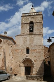
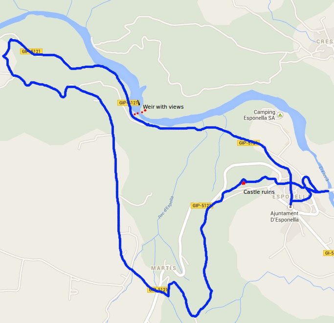
 Our starting point is just outside the adjuntament building just off the main road to Crespia and to start with we head up through the village to towards the church. We were slightly expecting more from the village given it's position. It is pleasant enough with stone built houses and narrow streets climbing up the side of the valley to the church and a host of newly renovated buildings, but we're a little bit spoiled for choice of pretty villages closer to home.
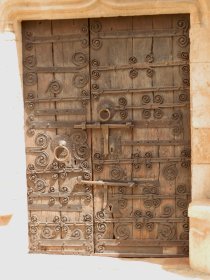
We reach the church with it's ornate hinged door, then continue straight on into the woods past the colonies house of Can Que. The woods are green and deciduous with a mass of flowers and grasses growing in the damp undergrowth. Down to the right is a campsite on the side of the river. As we're walking we can hear a cuckoo in the distance and it feels like a summer walk in a more northern European country.
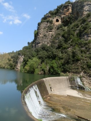 The track continues gently downwards and is marked as a BTT route for mountain biking. As we get closer to the river we're passed by a group of four riders coming up the track. The BTT route forks to the left, but we continue down to a weir and electricity generating station now able to see that the river is quite broad with deep pools and cliffs on the opposite side of the bank. In the wall of the cliffs is a wall with a hole - marked on the map as the site of a former hermitage.
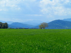
The weir itself is high, like a small dam with water rushing over the top. Behind the weir the river forms a broad tranquil lake in amongst the trees. We keep walking now level with the river next to a plantation of regularly spaced lime trees. The path seems like we could continue walking all the way to Banyoles following the river, but instead we take the first left up the hill into the woods and walk up to the top to find fields and views towards the Pyrenees.
We rejoin the BTT route and follow it as it turns to a tarmacked road past farm houses and an old people's centre. The road passes fields now - of bright yellow rapeseed and growing fields of wheat. In the distance the hills ebb and flow rolling away to the distant mountains.
 We reach the upper part of Martis and cross the road through the back of the hamlet following the track down the hill to the castle ruins just above Esponella. The castle would have been quite large, but now is little more than thick tumbledown walls.
We continue down to the village and past the church once more. Since the bridge is marked as a feature on the map we go down to the river to find a narrow but relatively modern looking bridge of stone arches and metal before returning to the square by the ajuntament.
Nearby: Sadernes and river pools of St Aniol d'Aguja - Sant Esteve d'En Bas (Olot) - Serinya and Illa del Fluvia - Olot - capital of Garrotxa - Banyoles lakeside walk - Visit to Besalu and Banyoles

 Walks and other things