Lladó (between Figueres and Besalu)
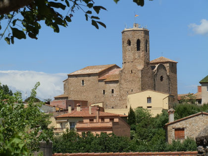 The area between Figueres and Besalu and the area of the hills towards the French border is not one that we've particularly explored until this year. We discovered Sant Llorenç de la Muga for the first time relatively recently and so wanted to find out a little more about Lladó - a town not so far away as the crow flies, but within a different set of hills.
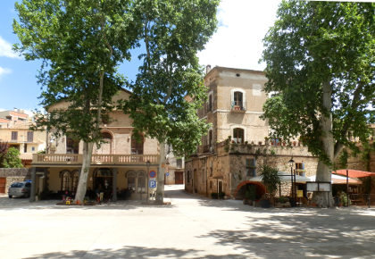
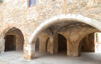
Lladó itself is a small town noted for its arches and monestary and has an almost French feel to it, with a large town square marked out by plain trees in the French fashion.
 As we keep telling people, one of the remarkable features of the Costa Brava area and its inland neighbours is the variety of landscapes that can be found in a relatively small area. While at the coast we have rocky sea cliffs and bays that run out to paddy fields, hills of alzinas and cork, as you move closer to the hills and mountains that separate France and Spain, the landscape becomes steeper and more dramatic and the vegetation and almost climate seems to change. Even to the point that just going 10km can see the landscape change from dry hills and rough garriga (low shrub rocky hills) to lush fields and deep woods in among the hills.
 So our aim of visiting Llado was more to see what was there, not because of any particular expectations of what it would be like.
To get to the town is mostly a one road in and one-road out place, though it does sit on a couple of long distance footpaths that run across and through the hills. The town sits on a rise, so as you come in you become aware of the vista across the plain towards Figueres and out to the sea. However, to get the view you need to explore a little towards the church.
 As mentioned, we had relatively little awareness of what to see, so as we normally do, we explore to see what we can see. Obviously we want to get to the church area to try to see the view, but a second section of the town is off to the right, and this is where we find the main town square and the area of the old monestary.
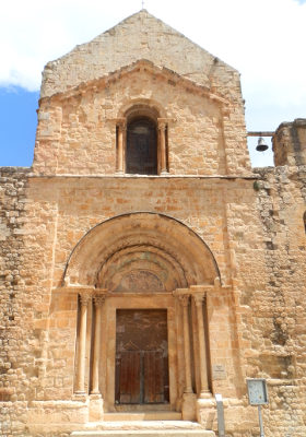
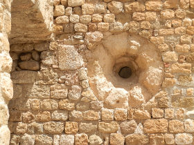
The monestary itself is now part of the ajuntament, and being European election day, the place is open for voting, so we can go underneath the arches and then visit the inner courtyard around the corner from the very elaborate doorway of an older chapel. The stonework is all golden with small round windows like ancient portholes on the side of the building.
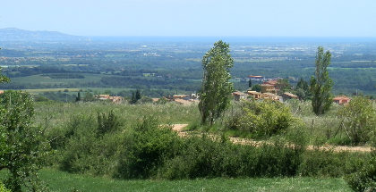
 From there we explore up to the church on the hill looking out towards the gulf of Roses in the distance across the fields. We then have to make a decision about where to walk. The map has a place called Manol which is marked as a building of historic interest not far from a river.
Instead of heading there directly we follow the path towards the Mirador de l'Emita de Sant Jaume i Sant Felip hoping to find links across to where we want to go.
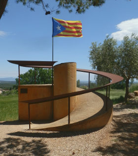
This is a steady easy path into the countryside, past a football pitch with real grass (most Catalan football pitches are artificial grass, so this indicates the difference in climatology) and then out past houses and farms. Eventually the signs take us through some cool woods and then up to the view point. A small platform with a flag is next to the chapel with views to the hills and across the plain below.
 From here we wing it - and it possibly isn't our best decision (not least because we're off the map). We follow the route into the hills past fields of cows with cow bells before looping over a hill and navigating ourselves down to a field in the next valley where we discover the river we had hoped to find.
We think it should be a simple case of following the river valley down and out to reconnect to Llado itself. However, we'd managed to loop ourselves to the back of a large cow farm that blocked the route at precisely the point where we wanted to cross the river.
Cow farms are relatively unusual by the coast - some farmers have small cattle sheds, but you don't see cattle in the fields for the most part. The cow farm blocking our way though is enormous. Not wanting to cross private property, the map seems to indicated that we might be able to go over the hill at the back to get around it. So we turn the 'wrong' way and trying going up - only to be blocked a second time. As we go back down we notice a different turning with a Mountain Bike Route sign - at least indicating that we're on a public path - and this goes even further up the hill. This one does the job at takes us up to the top of the farm, where we have to pass through the upper parts of the farm and out past a very massive old massia building - the one marked as the historic building.
Fortunately, we can now find our way back to the village and take a well earned drink in the square. For visiting, the plainer walk to the mirador would have been sufficient combined with the delights of the town itself.
Nearby: Sant Llorenç de la Muga - Figueres and Castell de Sant Ferran - Waterfall at Les Escaules (Boadella) - Espolla to Rabos - La Jonquera to Fort de Bellegarde (France) - Ceret (France) - Sadernes and river pools of St Aniol d'Aguja - Visit to Besalu and Banyoles

 Walks and other things