Swimming and visit to Panta de Sau
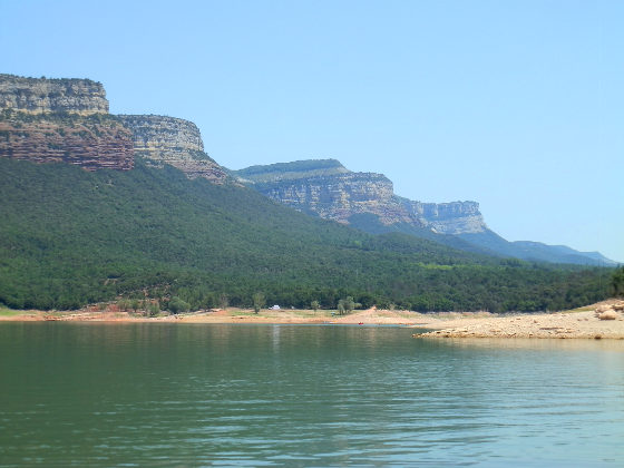
The Panta de Sau is a large lake in the dramatic landscape between Girona and Vic, formed when they dammed the river Ter for water and electricity in the 1960s. The area is in among the Guillerias and is relatively isolated and difficult to get to, sitting beneath Rupit and the village of Taveret, with dramatic cliffs (cingles) and a canyon type of feel.
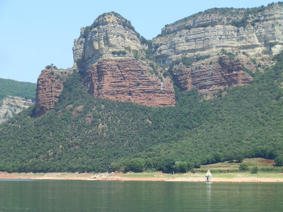
 The lake itself is frequently shown on the local weather forecast, because the damming for the lake led to the flooding of a small village and church. In dry periods, as the reservoir water level drops, the top of the church emerges from the water and acts as a photogenic indicator of the level of water available in Catalonia.
So, as ever, we like to go and look for interesting places to swim and visit, particularly during the summer when the coast starts to fill. We had considered visiting several times in the past, but the lake itself is relatively remote, so not too easy to access.
To get there from the coast we have to drive almost to Vic and then take a 15km winding road down from Folguerolas to Vilanova de Sau and then to the dam. The road is good, and passes through some lovely scenery, but it's slow going and just about wide enough for two cars to pass. In principle you can continue on up to Rupit, but the road seems to be even narrower on the other side.
 As a first visit, we're not sure what to expect. We know there are kayaking and boating stations down on the lake but not much else.
So our first stop is down to the dam itself. The drive goes up into the hills to start, before passing by red rock slopes through a tunnel and then underneath similar rock cliffs above what are pleasant small green fields.
Towards the bottom we find a small group of houses, one of which has a cafe or restaurant and another with a holiday home. We initially park here, thinking there might be a footpath to the lake, but it looks like everywhere is private. So we continue the extra couple of kilometres down to the dam itself.
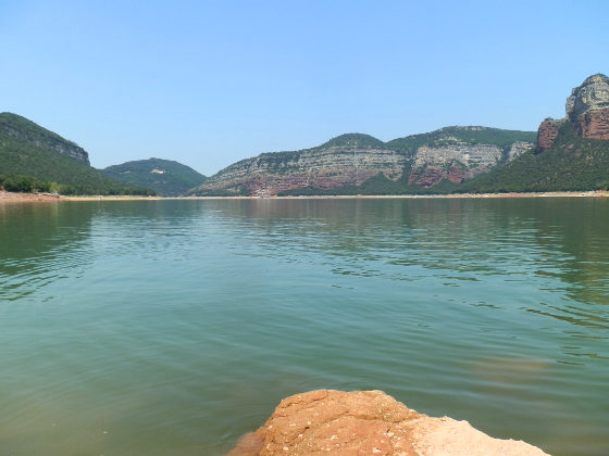 Being summer, the lake is already low - reports said around 65% full - so the exposed lakeside banks are dry gravel down to the water, and the water itself is a little on the green side.
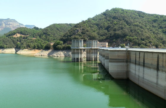
The dam has a small information centre and exhibition with pictures of the valley before it was flooded and on the non-lake side of the dam you can see the river down at the bottom of the valley a way below the top, showing the height.
Around about are high walls of almost primeval cliffs like the face of a canyon above the lake. There are walks up to Taveret and Rupit, and some cyclists go this way.
Looking out from the dam, we can see that this end of the lake is buoyed off, presumably for safety, but we can see canoes on the beaches further up the lake.
 So we head back to take a small junction we had passed just before the group of houses, further up the road. And drive down a single track road (4m max) to a colonies house at the bottom just above the lake. The colonies house is busy with loud noises of children having fun coming from the swimming pool, and plush green grounds.
Having parked, one route would take you to the kayak centre, but we take the other direction marked as the Parador de Sau and then skirt around the colonies estate finding a back path down to the lake itself. With the water level being low, there are gravel flats down to the water itself.
Across the lake we can see the top part of the church sticking of water, and pools of canoes and stand-up paddlesurfers out on the water inspecting the church.
It is incredibly serene. The water is flat and quiet with this huge expanse of water under the cliffs. On the other side of the lake are two more water areas - one is a sailing and waterski club and from time to time a water skier comes out onto the water. Another family comes down to the 'beach' where we are for a picnic.
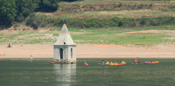 We then have to decide whether or not to go in the water. Apart from the kayakers we can't actually see anyone swimming and we're not entirely sure how safe it is. However, we do go in, and later see others swimming in the water.
By the edge is warm, with the green algaeish tinge, but further out it feels cooler, though we still take care as it's an unknown for swimming and don't venture too far out. Our feeling is that if this was America in places like Georgia, it would be overrun with people and boats enjoying the water. But here it feels like the middle of nowhere. A special place, but difficult to reach. If we were to come again then we might look to go to other side as it would be possible to reach the church via the water and the parking looked easier.
Nearby: - Santa Coloma de Farners - Brunyola - Arbucies autumn walk - Visit to Roda de Ter and Espinelves - Rupit - Els Set Gorgs (Campdevanol) - Sant Esteve d'En Bas (Olot) - Olot - capital of Garrotxa

 Walks and other things