Volca de la Crosa - Sant Dalmai (Girona Airport)
 The area around Girona, particularly La Garrotxa and Olot, is famous for extinct volcanoes and these extend south from Girona too, around the airport. In fact, if you're in Girona airport and look out to the surrounding countryside, you'd easily spot the classic tall, flat-topped mountains that in former times (millions of years ago), would have been active volcanoes.
The largest extinct volcano on the Spanish mainland is the Volca de la Crosa which is just a few kilometres from the airport itself between the villages of Aiguaviva, Salitja and Sant Dalmai. However, this isn't one you'd see easily, as the walls of the old caldera are relatively low rising no more than 30-40m above the plain with woods now on the sides.
Since we currently have to make regular weekend trips to Caldes de Malavella to pick up and drop off for the train to Barcelona, we spotted the green star marking a place of special interest that we thought we'd explore. Of course Caldes de Malavella itself is town with hot springs, and former Roman baths, and it too has a hidden volcano out at the Camp del Ninots.
 Early February is also the most likely time in the year for snow to come down to the lower hills and mountains. As the temperatures drop, the lower the snow comes. If the conditions are right it can even come down to sea level, and we've had a short flurry in the air one day this month. However, for the most part the snow stays higher than 600-800m meaning only the higher hills and mountains turn white.
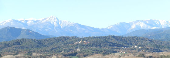
Nevertheless, this is still sufficiently low for the upper parts of Montseny to have snow. In fact Montseny rises to about 1500m, and can be seen in its snowy-dress from the beach in Barcelona on a clear day, and while we're used to seeing a white Canigou on the Pyrenees in the distance, seeing Montseny with snow is quite magical because it's much closer.
So having done the train drop, we continued out past the airport and then across to Aiguaviva with a white-coated Montseny in the near distance, and down to the large parking area that sits just outside the volcano itself, with views to Brunyola and Montseny beyond. The day itself was clear, as the Tramuntana wind had blown away the dust, and with a bit of sun was still 10-11C, so perfectly good walking weather.

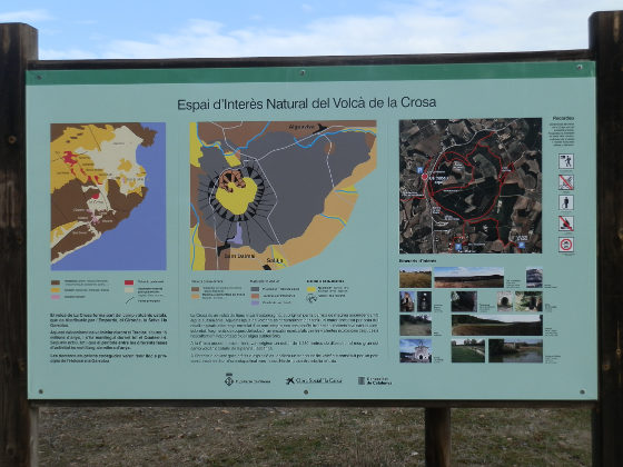
The Crosa itself has well marked tracks and lots of useful signposts to explain the history and generation of the volcano. The caldera itself is around 1250m in diameter - so more than a kilometre around, but once you add the rim and walk across the centre, and then out to the villages, our walk took more like 2 to 2.30 hours - around 8-9km.
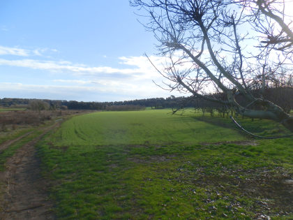
However, since the rim is relatively low, and the centre of the old volcano is now flat meadow lands with orchards of walnut trees, it doesn't have spectacular pictures as you might expect from a volcano. Instead it makes a pleasant walk.
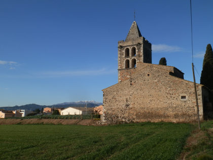
In practice we meandered around the paths, and this is as good a way to explore as anything, so there's no set route as such. From the parking we followed the rim to the east, before following the path into the volcano centre. From here we walked across the centre in want is now flat fields and small walnut groves, before climbing the rim almost where we started. From here we went south along the rim top through the woods, before heading to Sant Dalmai. Sant Dalmai is a small farming village with a small church, but not so much else of interest. We then linked to the next village of Salitja before turning back to the volcano at the Ermitage of the Fonts. The Ermitage has a small natural spring next to a low chapel, though the water is untreated and not for human consumption. From the chapel, we returned to the rim top of the volcano and completed the circuit via the eastern side.

See also: Hostalric stroll - Lake at Sils - Castell de Montsoriu - Brunyola - Arbucies autumn walk - Visit to Roda de Ter and Espinelves - Caldes de Malavella - Llagostera to Sant Llorenç - Girona and Castell de St Miquel - Girona valley of Sant Daniel - Cassa de la Selva - Bonmati and Anglès - Santa Coloma de Farners

 Walks and other things